Tag: Map
-
Rare 1931 Map of Johannesburg tram system
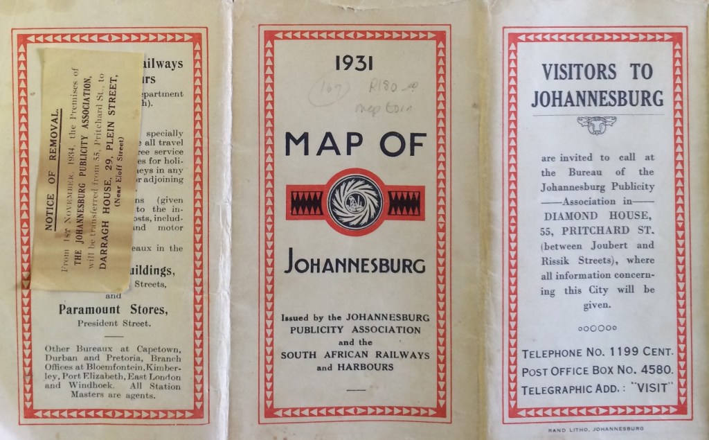
My book dealer tracked down this rare map of the Johannesburg tram system from 1931. I’ve taken a picture of the full map but as it’s quite a big fold-out map, it doesn’t photograph clearly. There are some smaller and clearer sections of the suburbs presented below as well as tram information printed on the…
-
Jeppestown & Belgravia Pt.3 (St. Mary’s-the-less, Gilfillan Park surrounds, Wesleyan Church, Jeppestown Masonic Lodge and Oddfellows Hall)
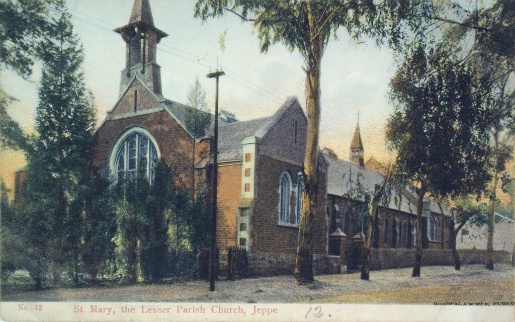
In the 1890 map, one can see the original layout before the railway line, Belgravia to the east and other surrounding areas like City & Suburban and Wolhunter. Commissioner Street is still called Natal road and there is a little stream and lake called Natal Spruit. The 1896 map shows the growth that took place…
-
Saratoga Avenue after Harrow Road bridge (Now called Joe Slovo Drive)
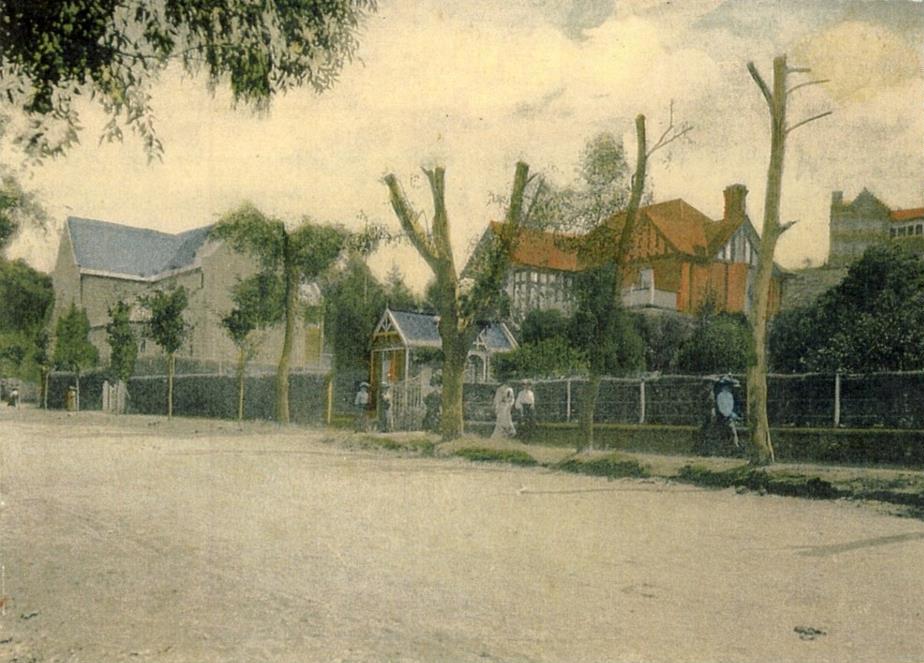
I was about to complete the Doornfontein post (finally took the balance of the pictures this week) but wanted to first post some pictures of the houses on the other side of the Harrow Rd bridge. Actually there is only one house left on Charlton Te…
-
Saratoga Avenue
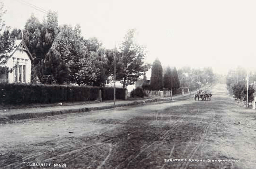
The well-heeled of the population were not satisfied with living in the small blocks laid out by the town planners near the mines and noise and dust of the new town. In 1887, Johannesburg’s first luxury residential area was laid out by Yeo Sherwel…
-
Early sweeping views
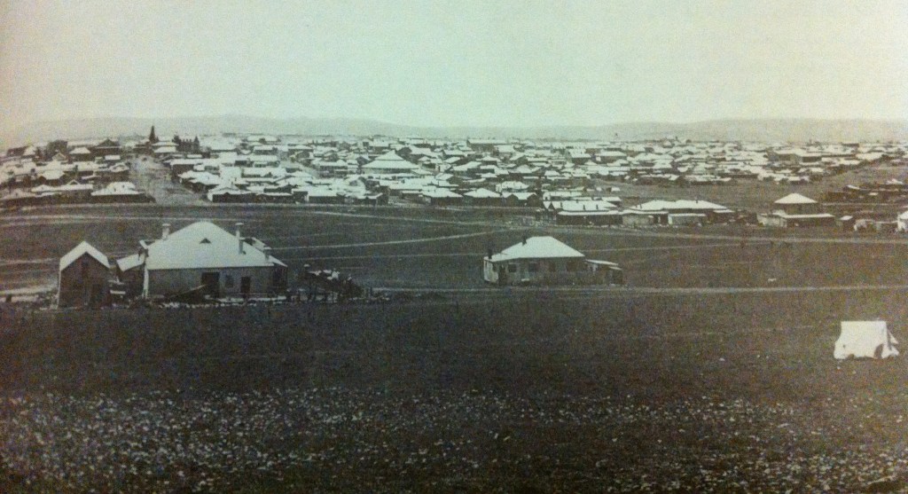
I’ve read that Johannesburg has been rebuilt three times. Initially it was a haphazard town akin to the wild west with lots of tents, tin structures and bars (and some clay huts-these prohibited after 1891 building regulations) With early deeper m…
